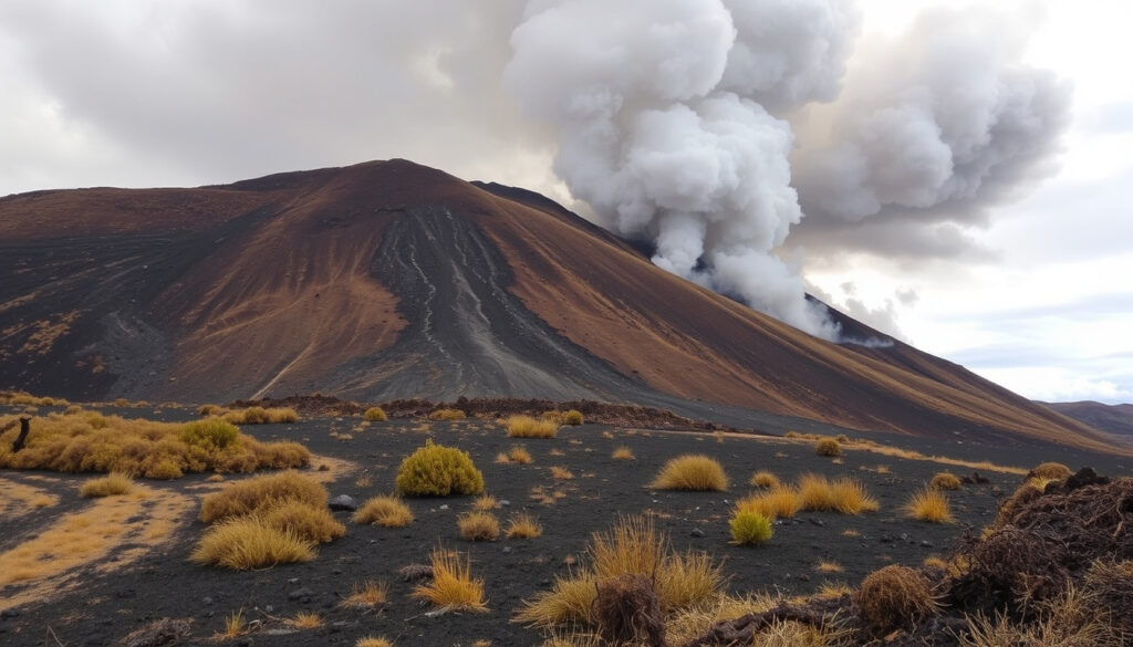
Tongariro Wildfire: Latest Updates and Hiker Guide
Anyone with a Tongariro Crossing booking in the next few weeks already knows the feeling: one fire update can rewrite a carefully planned hiking day. A wildfire that began on Saturday, 8 November 2025 burned approximately 2,935 hectares of Tongariro National Park before follow-up checks found no new hotspots.
Area burned: approximately 2,935 hectares ·
Highway closure: SH47 between SH48 and SH46 ·
Residents returned: Sunday, 9 November 2025 ·
Rāhui period: 9–17 November 2025 ·
Visible fire status: no visible signs of fire after rain
Quick snapshot
- The November fire burned approximately 2,935 hectares (Department of Conservation).
- State Highway 47 was closed between SH48 and SH46 during the response (Fire and Emergency New Zealand).
- Follow-up crews found no new hotspots (Department of Conservation).
- The official cause is not confirmed (Fire and Emergency New Zealand).
- No final containment percentage appears in the official updates cited here (Fire and Emergency New Zealand). (Fire and Emergency New Zealand)
- Full reopening of the Tongariro Alpine Crossing is not confirmed (Fire and Emergency New Zealand). (Fire and Emergency New Zealand)
- The fire began Saturday, 8 November 2025 (Department of Conservation).
- Estimates climbed from 1,600 hectares to 1,800 hectares at 20% containment on 9 November (Fire and Emergency New Zealand) (Fire and Emergency New Zealand).
- The seven-day rāhui ran 9–17 November 2025 (Department of Conservation).
- Check DOC trail alerts and FENZ incident updates before travelling (Department of Conservation) (Fire and Emergency New Zealand).
- Reopening decisions hinge on hotspot checks in terrain that blocked full ground access (Department of Conservation).
- Treat official channels as the authoritative guide for maps and road closures (Fire and Emergency New Zealand).
Key facts
Ten facts, one pattern: every number in this event moved as crews got closer to the ground.
| Fact | Detail |
|---|---|
| Location | Tongariro National Park, described by DOC as New Zealand’s first national park and a dual UNESCO World Heritage site (Department of Conservation). |
| Area burned | Approximately 2,935 hectares (Department of Conservation). |
| First official estimate | 1,600 hectares on 9 November, described as not controlled (Fire and Emergency New Zealand). |
| Revised official estimate | 1,800 hectares at 20% containment, later the same day (Fire and Emergency New Zealand). |
| Fire start | Saturday, 8 November 2025 (Department of Conservation). |
| Rāhui | Seven days, 9–17 November 2025, set by Ngāti Hikairo ki Tongariro (Department of Conservation). |
| Highway closure | SH47 closed between the SH48 and SH46 intersections (Fire and Emergency New Zealand). |
| Trail closures | Tongariro Alpine Crossing (Fire and Emergency New Zealand); Mangatepopo Track and the northern Tongariro Northern Circuit (Department of Conservation). |
| Precautionary evacuations | Five facilities near the fireground (Fire and Emergency New Zealand). |
| Response team | FENZ, DOC, Police and iwi partners (Fire and Emergency New Zealand). |
Where is the fire right now?
The November fire hit the Whakapapa side of Tongariro maunga. The initial rāhui covered the mountain, the fireground, Whakapapa-area walks, and the tracks in and out of Whakapapa Village (Department of Conservation (rāhui guidance)), which gives the clearest picture of where the burned area sits.
Where can I find a Tongariro National Park wildfire map?
- No official live map appears in the official updates used for this briefing. The most reliable map sources remain Fire and Emergency New Zealand (national firefighting agency) incident updates and Department of Conservation (land management agency) Tongariro pages.
- A no-fly zone over the fireground and surrounding area restricted aerial mapping and drone footage during firefighting operations (Fire and Emergency New Zealand).
- For on-the-ground truth, DOC’s hotspot reports are the clearest signal: follow-up searches found no new hotspots (Department of Conservation).
What is the latest Tongariro National Park wildfire update?
The fireground is quiet in the latest official checks, but “no new hotspots” is a firefighting milestone, not an access announcement.
- After the fire, DOC deployed two crews totalling 13 personnel to search for hotspots in difficult terrain (Department of Conservation).
- The rāhui set by Ngāti Hikairo ki Tongariro ran from 9 to 17 November 2025 (Department of Conservation).
- Later checks reported no visible signs of fire after rain, in line with DOC’s finding of no new hotspots (Department of Conservation).
The implication: the acute emergency phase looks finished, but quiet conditions are not the same as full access — reopening still depends on terrain checks and cultural protocol.
Is the Tongariro fire out?
No official update used here declares the fire out. What the record shows is a rapid 9 November assessment, a revised containment figure, and then a quiet phase of spot checks.
How many hectares burned in Tongariro National Park?
- DOC’s post-fire release put the burned area at approximately 2,935 hectares (Department of Conservation).
- On 9 November, FENZ first estimated 1,600 hectares and described the fire as not controlled (Fire and Emergency New Zealand).
- Later the same day, FENZ revised the estimate to 1,800 hectares with 20% containment (Fire and Emergency New Zealand).
Where can I check whether the Tongariro fire is fully extinguished?
“No new hotspots” is a firefighter’s measure, not a tourist’s all-clear. No final containment percentage or formal fire-out statement appears in the official updates cited here.
- Official fire-out and containment declarations come from Fire and Emergency New Zealand (national firefighting agency), not from third-party track blogs.
- DOC’s post-fire crews searched for hotspots in terrain that kept ground teams from full access during the height of the response (Department of Conservation).
- No new hotspots were identified during that crew deployment (Department of Conservation).
What this means: visitors can treat the acute phase as over, but “not visible from the air” is not the same as “formally extinguished” — and that distinction still decides what reopens when.
What caused the Tongariro fire?
Short answer: investigators are still working on it. The official record confirms the response, not the ignition.
What factors affect wildfire risk in Tongariro National Park?
- Terrain is the factor officials emphasised: DOC stated that difficult terrain prevented ground crews from accessing all fire-affected areas (Department of Conservation).
- The response combined Fire and Emergency New Zealand, the Department of Conservation, Police and iwi partners (Fire and Emergency New Zealand).
- The rāhui shows how cultural and ecological values are treated as part of the response, not an afterthought (Department of Conservation).
Who investigates the cause of a Tongariro National Park wildfire?
- Specialist fire investigators from Fire and Emergency New Zealand and Police were working to establish the cause (Fire and Emergency New Zealand).
- As of the latest official updates used here, no final cause has been confirmed (Fire and Emergency New Zealand).
The pattern: with the investigation still open, treat confident cause theories on social media as speculation until FENZ and Police publish their findings.
Are bushfires common in New Zealand?
New Zealand runs a standing wildfire response system, and vegetation fires are a routine part of the summer risk picture. What made this event different was where it burned: the country’s first national park.
How does the Tongariro fire compare with other New Zealand wildfires?
- At approximately 2,935 hectares, the burned area is more than 80% larger than the initial 1,600-hectare estimate — fire numbers move quickly as mapping improves (Department of Conservation) (Fire and Emergency New Zealand).
- Official reporting for the event centred on the crossing closure, highway closures and the rāhui — the signals of a fire with direct visitor and community impact (Fire and Emergency New Zealand).
- The official record does not publish cross-country fire rankings, so the fairest comparison is between the event’s own estimates: 1,600 hectares at the first briefing, then 1,800 hectares at 20% containment (Fire and Emergency New Zealand) (Fire and Emergency New Zealand).
Which country has the worst wildfires?
- The official Tongariro updates do not rank New Zealand against other countries, and this briefing does not stretch them into global comparisons (Fire and Emergency New Zealand).
- The useful context is local: New Zealand’s firefighting agency publishes incident-based reporting rather than a world ranking, and the official record here is the only reliable measure of what is happening on the mountain (Fire and Emergency New Zealand).
Why this matters: for visitors, the global “worst fires” contest is a distraction. What changes your plans is the local record — and the local record for Tongariro is specific, sourced and recent.
Is Tongariro Crossing open?
During the response, no. The Tongariro Alpine Crossing was closed while firefighting was active. Whether the full trail has reopened is not confirmed in the official updates cited here.
How does the fire affect Tongariro Crossing plans?
A closed trailhead does not always show up on a map search. The crossing closure was announced through official channels, so track apps and forums can lag behind.
- The Tongariro Alpine Crossing was closed during the November firefighting response (Fire and Emergency New Zealand).
- Mangatepopo Track and the northern section of the Tongariro Northern Circuit were also closed (Department of Conservation).
- Full reopening of the crossing is not confirmed in the official updates used here (Fire and Emergency New Zealand).
What should hikers do before visiting Tongariro National Park after a fire?
- Check DOC trail alerts first; track closure decisions are published there (Department of Conservation).
- Check FENZ incident updates for road restrictions and any remaining fireground limits (Fire and Emergency New Zealand).
- Respect the rāhui framework: the seven-day period ended on 17 November 2025, but the cultural protocol signals that the mountain is managed on more than firefighting terms (Department of Conservation).
The trade-off: hikers want certainty, but agencies are balancing visitor access against burn risk and cultural sensitivity. The official reopening answer will lag behind local hopes, and that lag is deliberate.
Timeline signal
From first report to rāhui lift, one pattern: the fire grew, access tightened, and official numbers kept climbing until rain and ground checks changed the picture.
- — fire begins in Tongariro National Park (Department of Conservation).
- — FENZ estimates 1,600 hectares burned and not controlled; five facilities evacuated; Tongariro Alpine Crossing closed (Fire and Emergency New Zealand).
- — FENZ revises the estimate to 1,800 hectares at 20% containment; SH47 closed between SH48 and SH46; no-fly zone in force (Fire and Emergency New Zealand) (Fire and Emergency New Zealand).
- — seven-day rāhui from Ngāti Hikairo ki Tongariro covers Tongariro maunga, the fireground, Whakapapa-area walks and tracks into the village (Department of Conservation) (Department of Conservation).
- — rāhui period ends (Department of Conservation).
- After the fire — DOC sends two crews (13 personnel) to search for hotspots; no new hotspots found (Department of Conservation).
The pattern: the official response moved faster than the public narrative — each updated estimate came with tighter closures, not looser ones.
Confirmed facts
Four claims hold up across the official record, each tied to a named agency.
- Approximately 2,935 hectares burned in Tongariro National Park (Department of Conservation).
- The Tongariro Alpine Crossing was closed during the firefighting response (Fire and Emergency New Zealand).
- Five facilities were evacuated as a precaution, and local reporting said affected residents returned home by Sunday, 9 November 2025 (Fire and Emergency New Zealand).
- DOC crews found no new hotspots after the fire (Department of Conservation).
What’s unclear
The official record is strong on the response and thin on the aftermath — the cause, the final numbers and the economic impact are still open.
- Exact fire cause: not confirmed (Fire and Emergency New Zealand).
- Final containment percentage: not published in the official updates cited here (Fire and Emergency New Zealand).
- Full Tongariro Alpine Crossing reopening: not confirmed (Fire and Emergency New Zealand).
- Tourism and business losses: local coverage around 11 November focused on hopes that rain would protect summer income, but no dollar figure appears in the official record.
- Active evacuation notices: the official updates cited here confirm the precautionary evacuations but do not confirm what remained in place afterwards.
The takeaway: treat the confirmed list as the floor and the unclear list as the ceiling — plan around what is known, and wait on the rest.
Official statements
Two agencies, two reminders: one about terrain, one about investigation.
Difficult terrain prevented ground crews from accessing all fire-affected areas.
Department of Conservation (land management agency)
Specialist fire investigators from Fire and Emergency New Zealand and Police were working to establish the cause of the fire.
Fire and Emergency New Zealand (national firefighting agency)
The implication: both agencies are telling the same story — the fire was fought within limits, and the final word is still pending.
The takeaway for hikers
The November fire burned through the Whakapapa side of the park, closed the crossing and the roads around it, and then went quiet under rain and ground checks. What remains is a park in recovery: the rāhui period has ended, hotspot checks are done, and reopening details are still resting with DOC and FENZ. For hikers with late-November or summer plans, the decision is clear: keep checking DOC trail alerts and FENZ incident updates before every trip, or risk arriving at a closed trailhead with no plan B.
Frequently asked questions
How many hectares did the Tongariro National Park wildfire burn?
Approximately 2,935 hectares, according to the Department of Conservation. On 9 November, Fire and Emergency New Zealand first estimated 1,600 hectares and later revised that to 1,800 hectares at 20% containment (Fire and Emergency New Zealand) (Fire and Emergency New Zealand).
Were any roads closed because of the Tongariro fire?
Yes. State Highway 47 was closed between the SH48 and SH46 intersections during the response (Fire and Emergency New Zealand). A no-fly zone was also imposed over the fireground and surrounding area.
How can I get Tongariro National Park wildfire alerts?
Official alerts come from two channels: the Department of Conservation for trail closures, and Fire and Emergency New Zealand for incident updates and road restrictions. Third-party track apps can lag behind both.
How did the Tongariro wildfire affect local businesses?
Local business coverage around 11 November focused on hopes that rain would protect the summer tourism season after the fire. No dollar figure for losses appears in the official updates cited here, so that economic accounting is still pending.
Are there active evacuation notices in Tongariro National Park?
During the response, five facilities near the fire were evacuated as a precaution (Fire and Emergency New Zealand). The official updates cited here do not confirm any active evacuation notices after that phase; current notices should be checked directly with FENZ and DOC.
When can visitors return to Tongariro National Park?
The rāhui period ended on 17 November 2025 (Department of Conservation), and follow-up crews found no new hotspots (Department of Conservation). Whether the full Tongariro Crossing has reopened is not confirmed in the official updates cited here, so check DOC trail alerts before travelling.
More related posts
 Chiefs vs Moana Pasifika: Time, Stream & Prediction Guide
 Asia Cup 2025 Schedule: Full Match List, Dates, Venues & Teams
 Yoga for the People: Fragmented Brand, Daily Yoga, Braless Trend
 NZX 50 Index Today: Live Price, Chart, News & Analysis
 Grow a Garden Code May 2026: Free Seed , Pet & Reward
 Martin Hawes Retirement Ready: Book Review & Guide
 Chocolate self saucing pudding: easy step-by-step recipe
 Gillette Fusion 5 Blades: Cost & Performance
